Le Schreckhorn, ou pic de la terreur, n’aura pas faillit à sa réputation de l’un des plus beaux 4000m des Alpes. Probablement l’une de mes plus belles courses en montagne de cet été. Pourtant cela commençait mal. Chute de neige le mercredi, un gardien qui tente de nous décourager de venir… et notre propre intuition que ça peut faire quand même. Comme souvent en montagne, le mieux c’est d’aller voir. Au pire on aura fait une belle marche ;)
En ce dernier samedi de septembre, direction donc Grindelwald, au pied de l’Eiger, un endroit que j’aime beaucoup. Le dépaysement est total en vallée avec le trio gagnant « chalets-géraniums-pelouse de golf », comme en montagne, où l’on se retrouvent seuls au coeur d’un gros massif. Y a pas à dire, cet endroit de la Suisse est simplement magnifique…
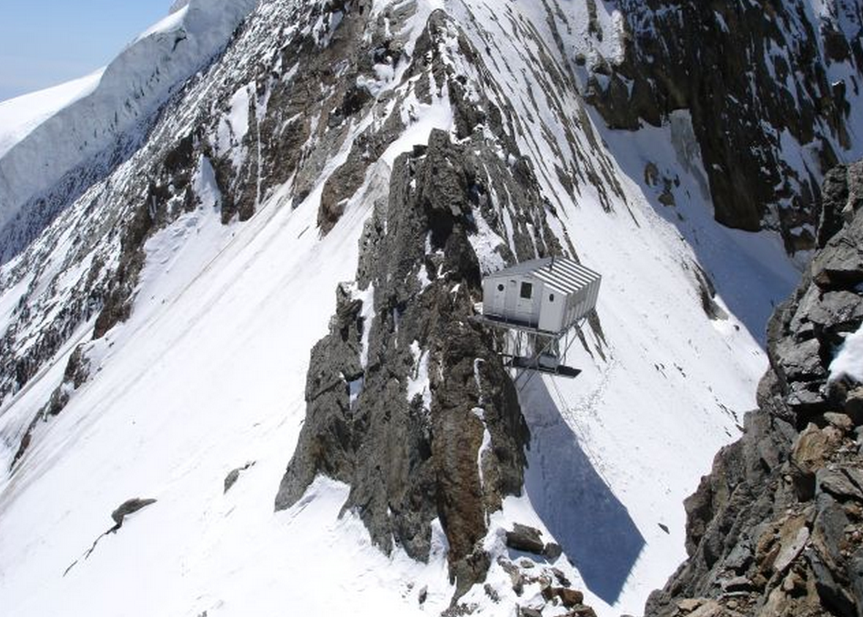
On opte pour la version la plus soft en prenant le télécabine de Pfingstegg et gagner un peu de déniv sur cette première journée qui nous amène en quelques heures à la Schreckhornhütte (le refuge). L’arête Sud Ouest n’a pas l’air trop enneigée de ce qu’on a pu en voir. Et nous avons l’agréable surprise d’apercevoir une trace sur le glacier, merci à la cordée de la veille!
Le couple de gardiens nous accueillent avec un verre de thé alors qu’ils sont en plein rangement. Ils fermeront lundi et nous sommes les derniers clients de la saison… La gardienne cuisine comme une chef et nous régale. Le gardien est un peu rustre mais contrairement à ce qui peut être dit sur certains sites web, il est sympathique et sérieux en se préoccupant des alpinistes qui passent par son refuge. (Je crois qu’il ne nous a pas lâché de la jumelle ;) )
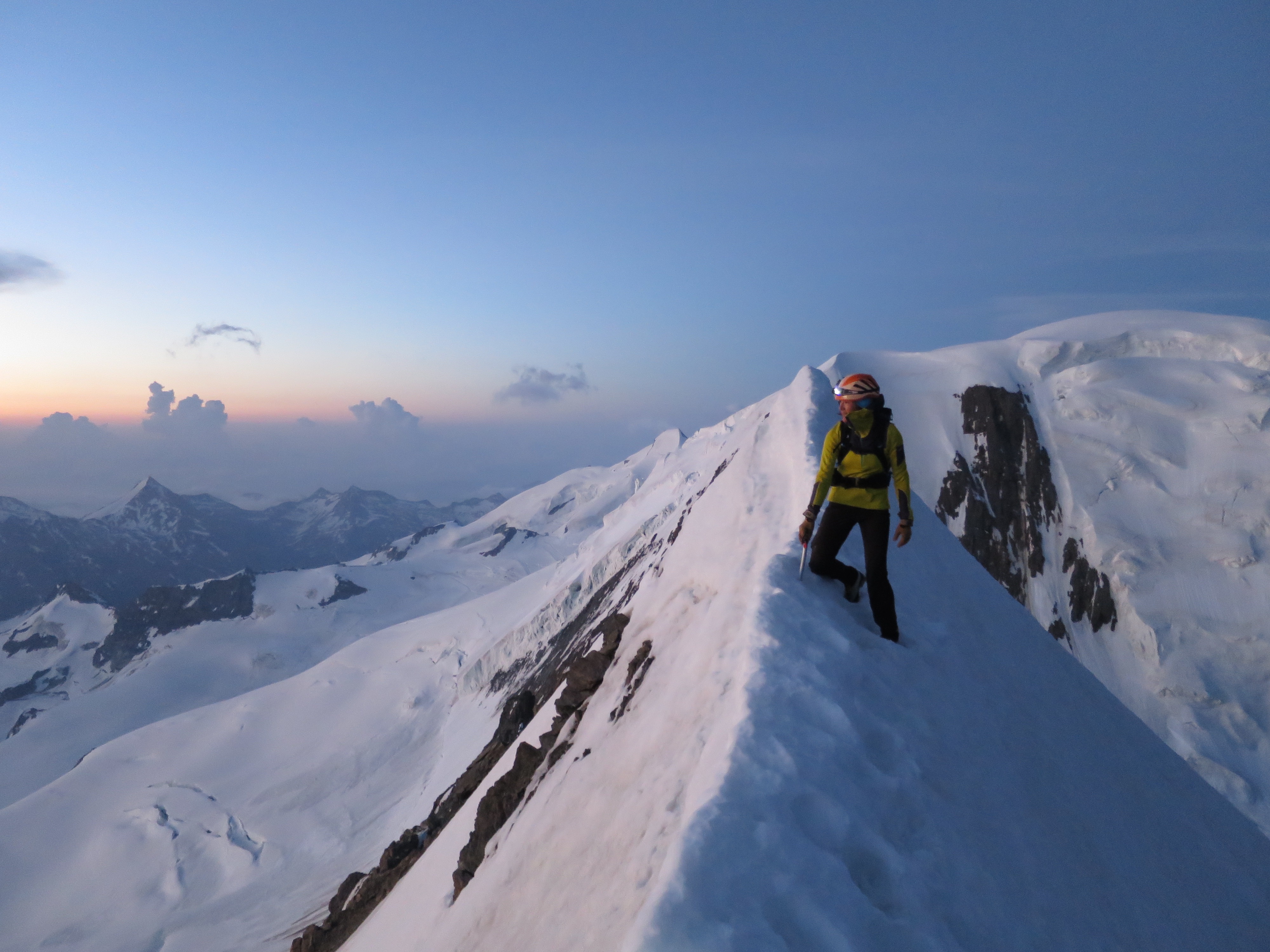
Dimanche, 4h du mat, c’est le départ. Descente de la moraine, traversée du glacier, remontée un peu plus loin. Il y a pas mal de kairns au début et une sente assez bien marquée qui disparait peu à peu avec la neige. La marche de nuit passe toujours assez vite et l’on se retrouve déjà sur le glacier. Il y a plus de neige que ce que nous pensions et le bout de trace laissé par la cordée de la veille est bien apprécié. Nous passons la rimaye par la droite, là où elle est bouchée et remontons le couloir à droite de l’arête, suffisamment enneigé. Enfin nous arrivons au rocher. Un rocher orangé compact aux grosses prises franches. Le type de rocher rassurant et facile à grimper. Au niveau condition, il y a de la neige (ça on l’avait compris dès l’approche) mais ça ne gêne pas vraiment. On va juste un peu plus doucement que si c’était sec. L’arête qui mène du Schreckhorn au Lauteraarhorn est bien enneigée aussi. L’enchaînement sera pour une autre fois, ce qui fait une autre bonne raison de revenir :)
A 9h30 nous sommes au sommet et l’on profite largement de la vue offerte à 360°. Le panorama est incroyable. Mer de nuages sur les vallées de la Suisse à l’Italie et Montagnes plâtrées blanches au-dessus. Les photos ci-dessous en parlent mieux que moi.
Que dire de la descente? Que l’on a brassé jusqu’au dessus des genoux dans la neige devenue molle? Oui. Que le retour jusqu’à Pfingstegg était un peu longuet? Oui. Que le parapente aurait été le bienvenu? pas faux. Mais c’est surtout la beauté des montagnes environnantes, le fait d’être seuls sur toute une course, et la variété de terrains qu’offre le Schreckhorn dont je me souviendrai. Avec un grand sourire aux lèvres.
Le Schreckhorn en chiffres :
 Altitude : 4078m
 Altitude du refuge : 2530m
 Tarifs remontée de Pfingstegg : 24 CHF
 Tarifs demie pension du refuge : 61 CHF pour les membres du CAF
 J1 : 1280m positifs
 J2 : 1660m positifs
 Matos que l'on a pris :
 Une corde de 50m, sangles de 120cm,
 Camalots (gris, violet, vert), quelques câblés
 Matos de glacier
PHOTOS : NILS NIELSEN et LIV SANSOZ
-

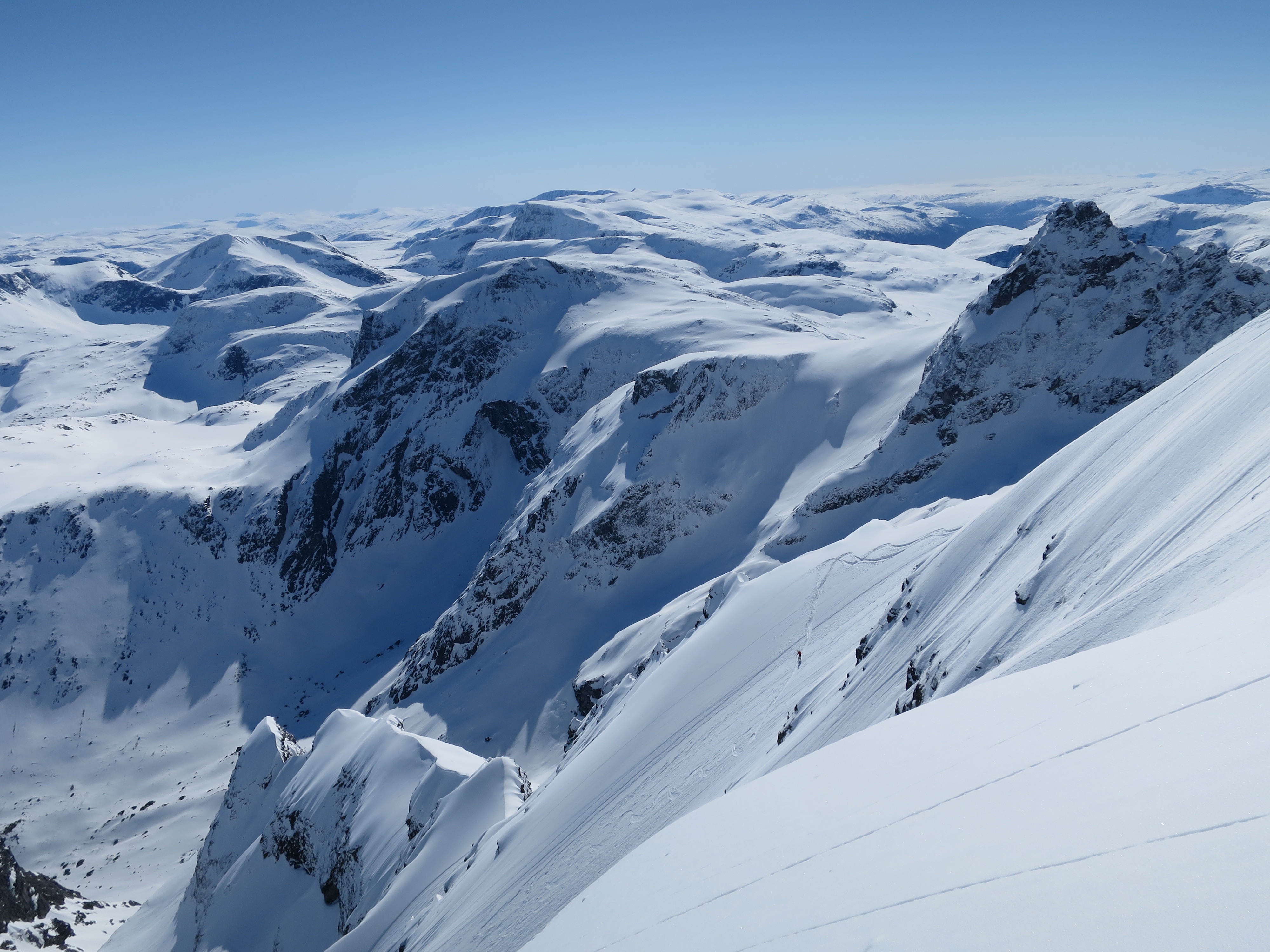
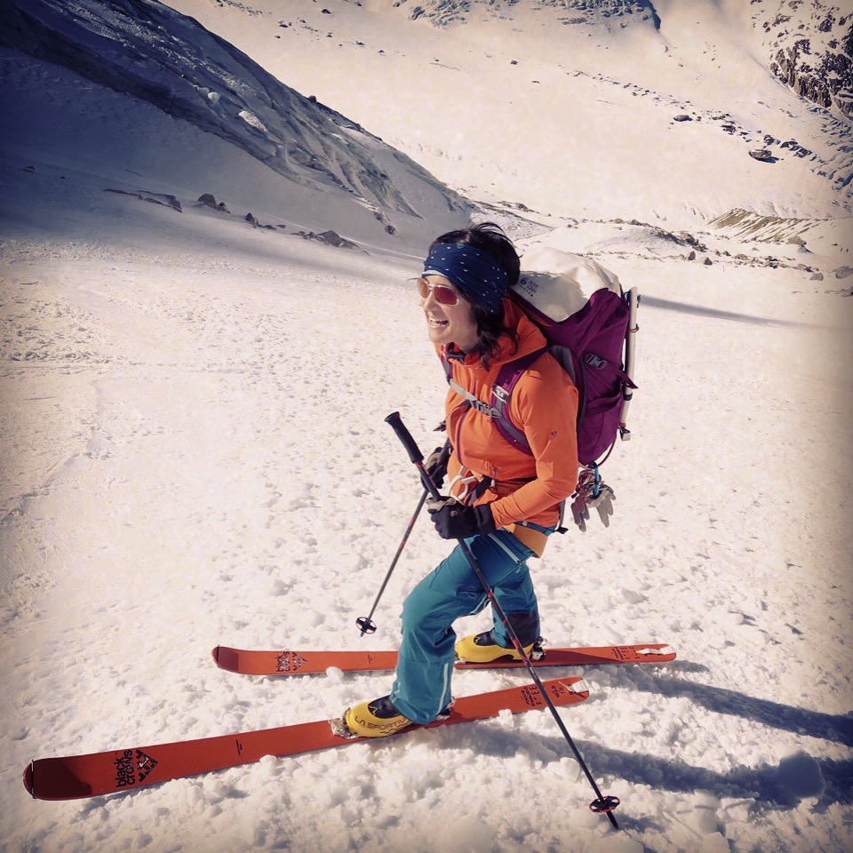
- J1, l’approche donne le ton et apporte son dépaysement
-

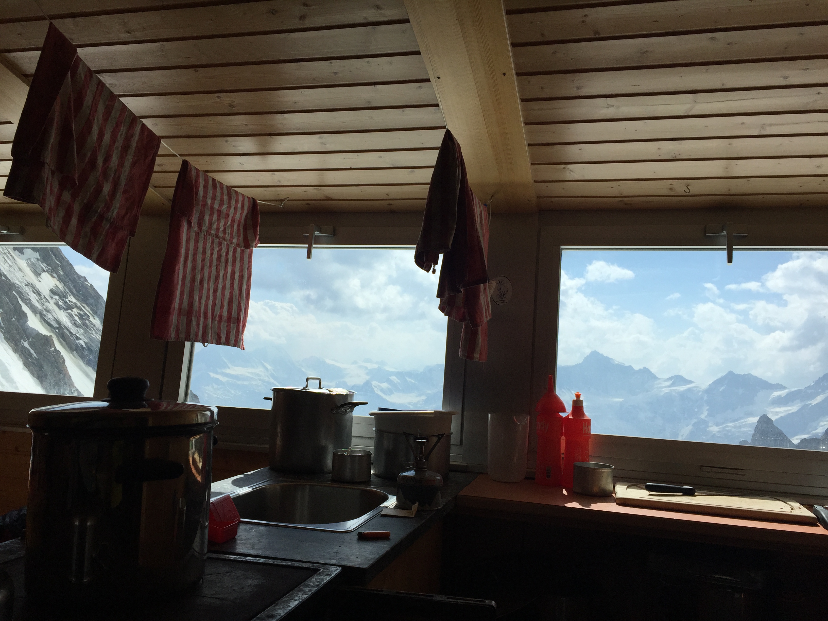
- La vue depuis le refuge et des montagnes qui nous font nous sentir bien petits…
-

- Lever de soleil sur le Finsteraarhorn
-

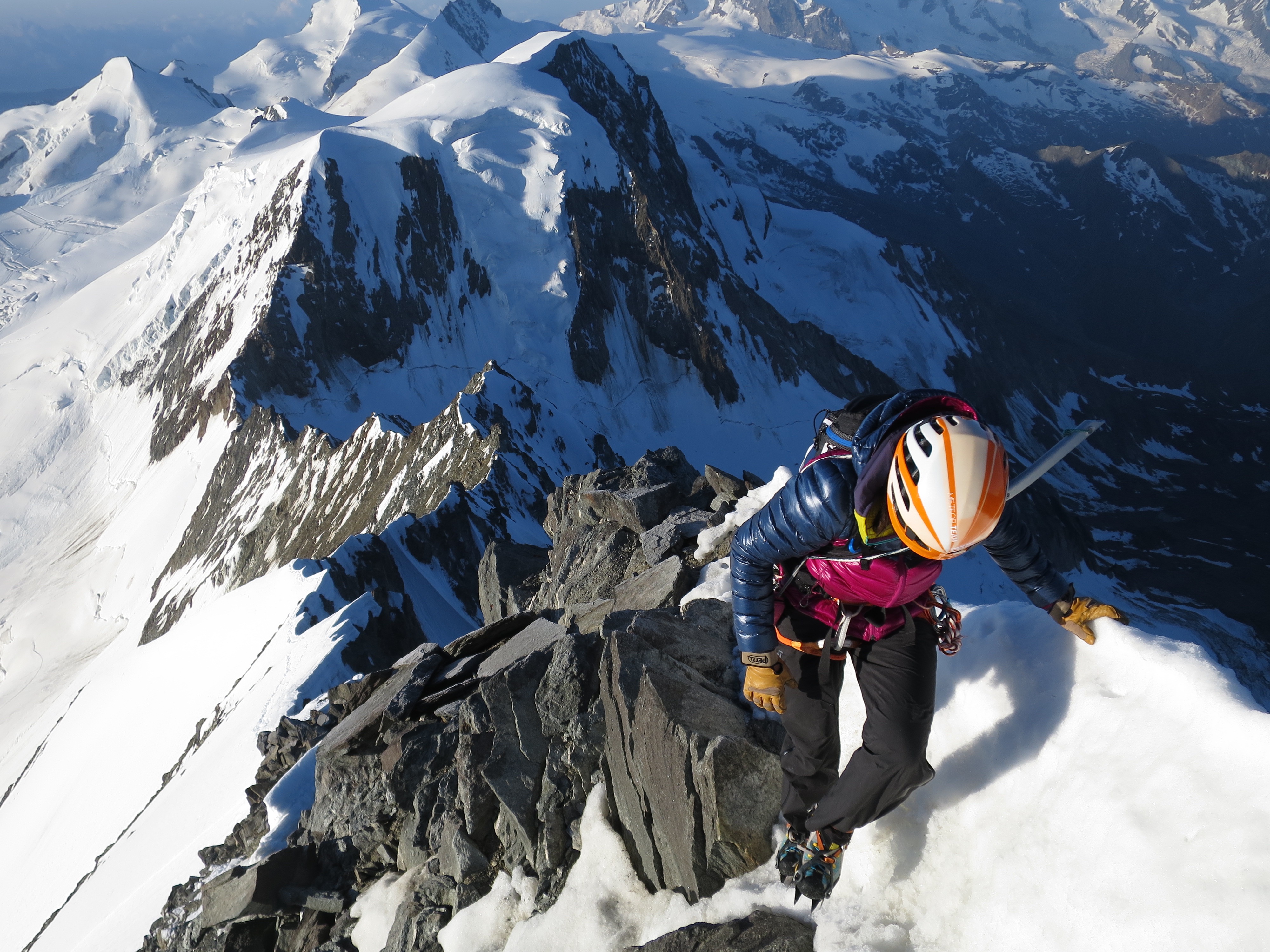
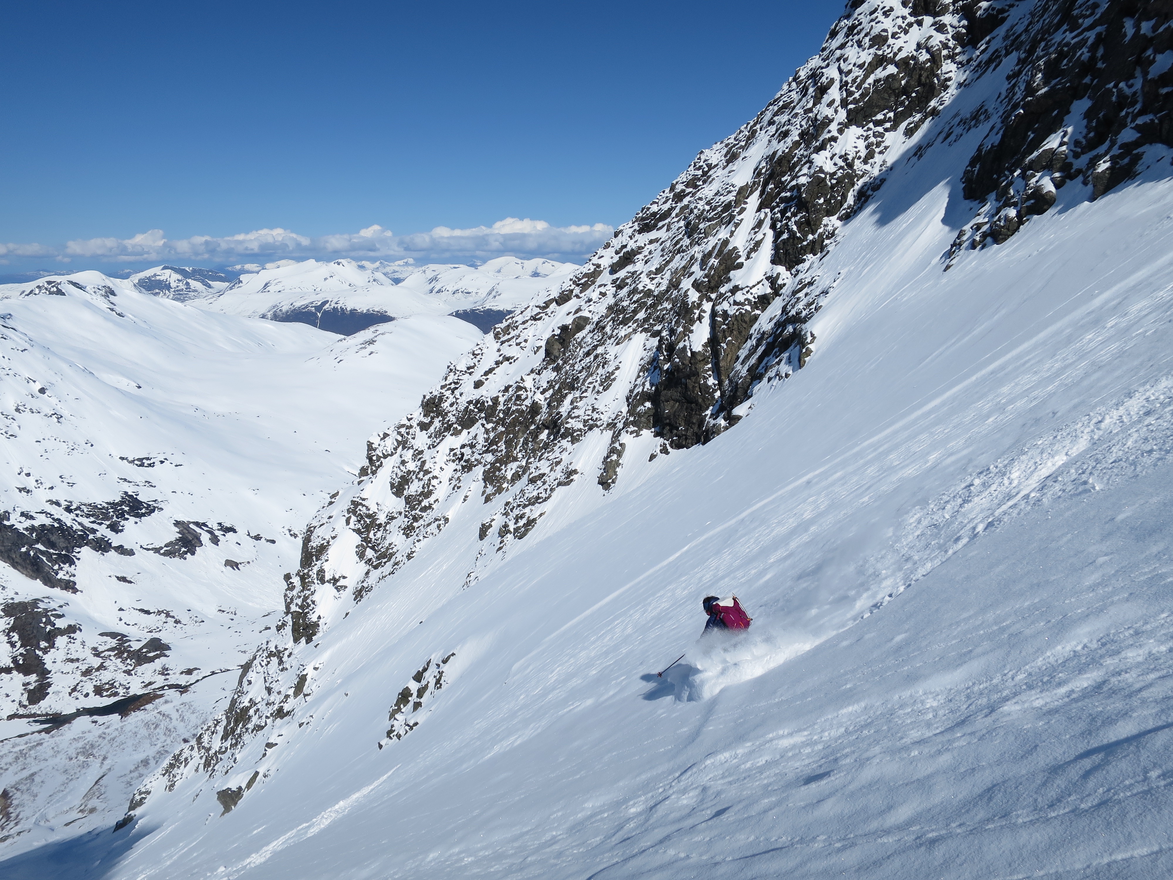
- La rimaye est passée, plus qu’à remonter le couloir de neige pour rejoindre ensuite l’arête et son rocher bien compact.
-

- La fin du couloir. Crampons, piolet et gros gants vont au fond du sac, corde, sangles et quincaill entrent en jeu…
-
- Un de mes moments préférés en montagne, quand le soleil me réchauffe le bout du nez
-

- Jolie mer de nuages sur la vallée, sympathique vue sur Eiger Monch Jungfrau et le sommet qui n’est plus très loin…
-

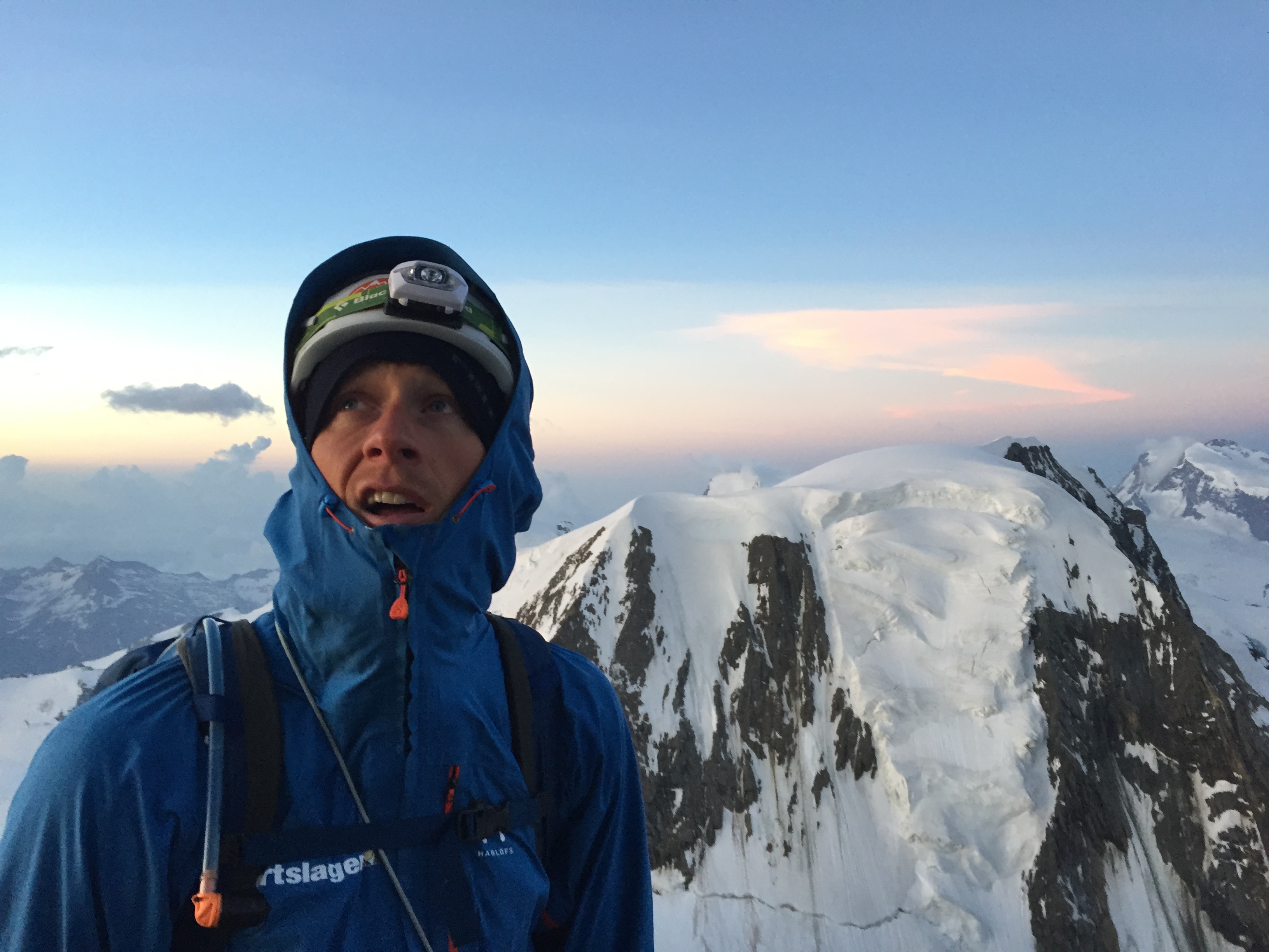
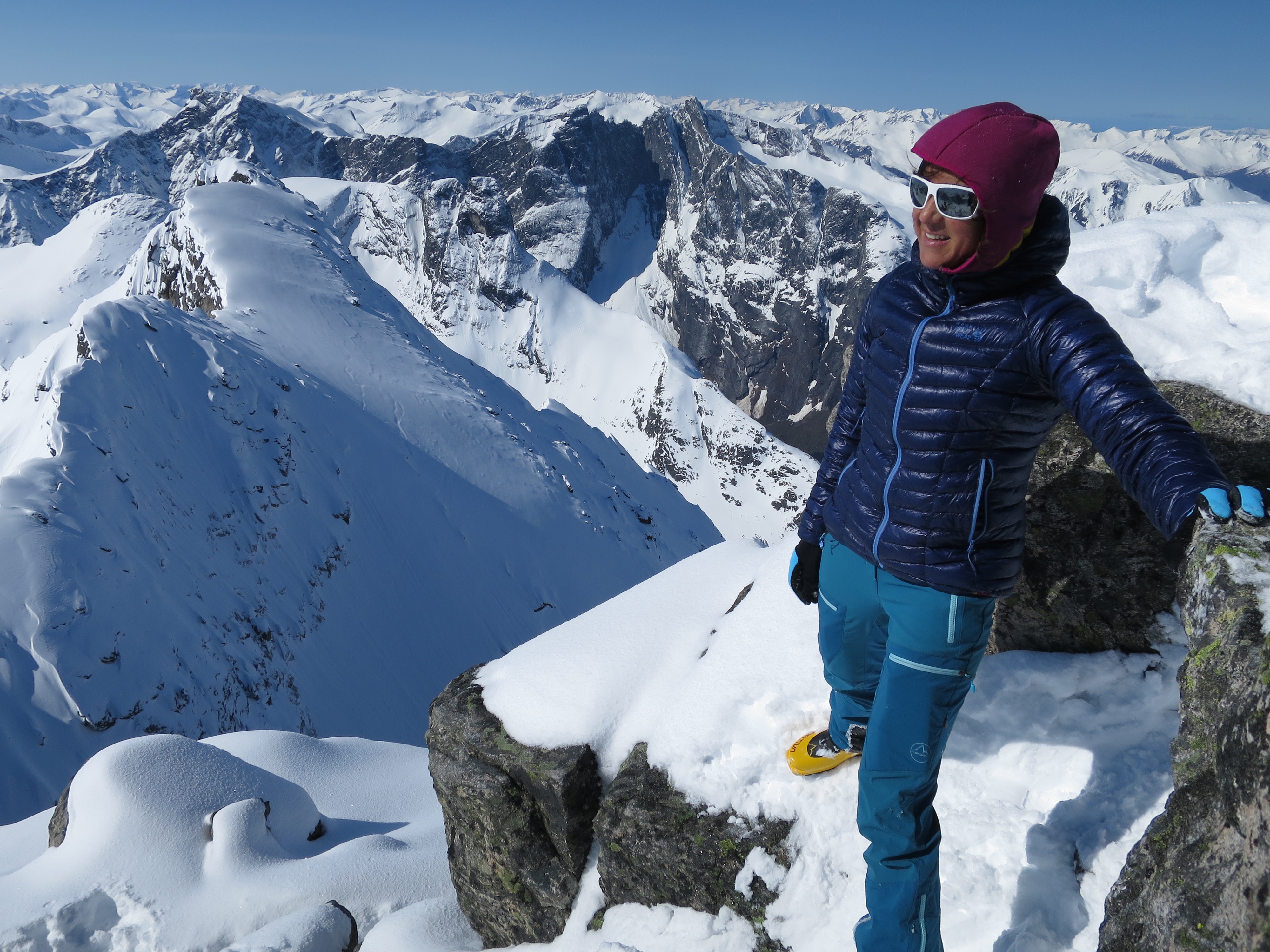
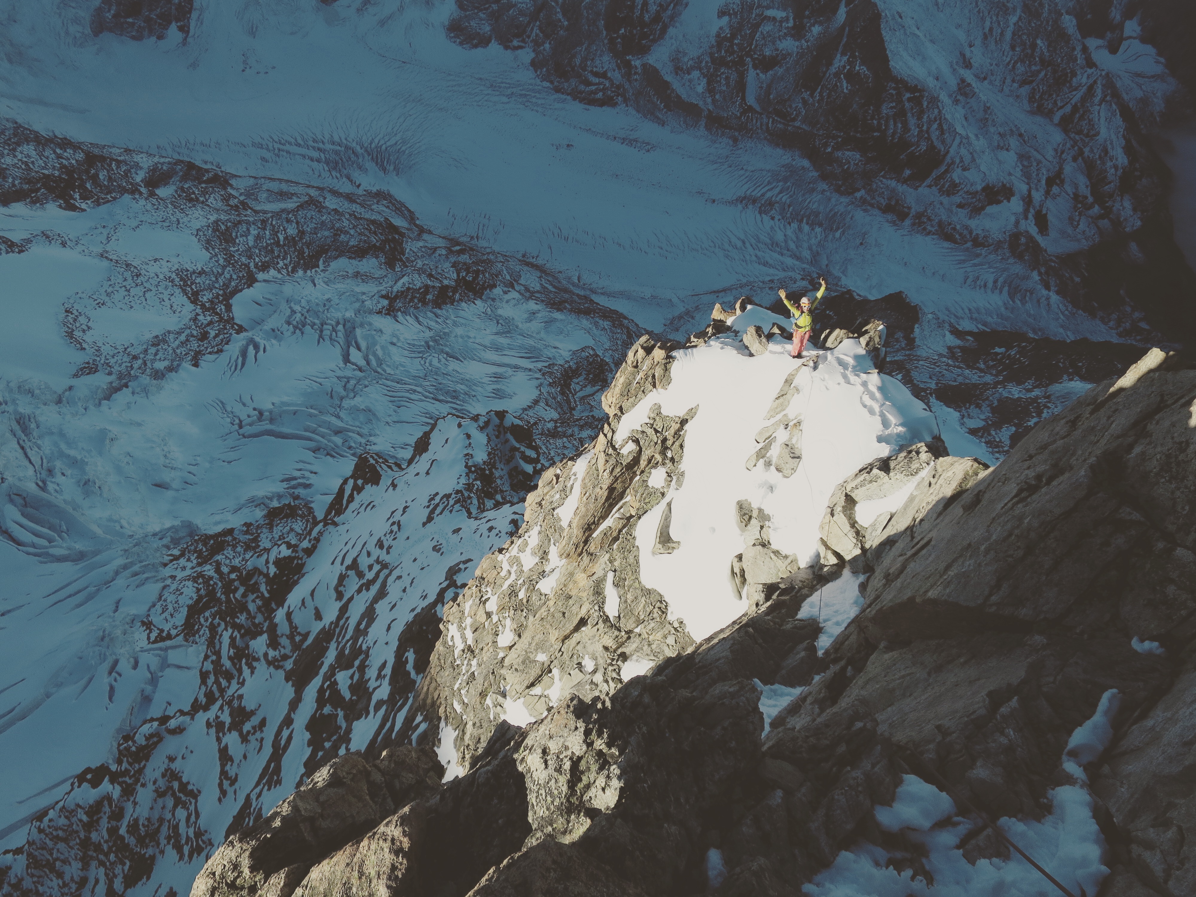
- Nils au sommet avec un tour d’horizon époustouflant.
-

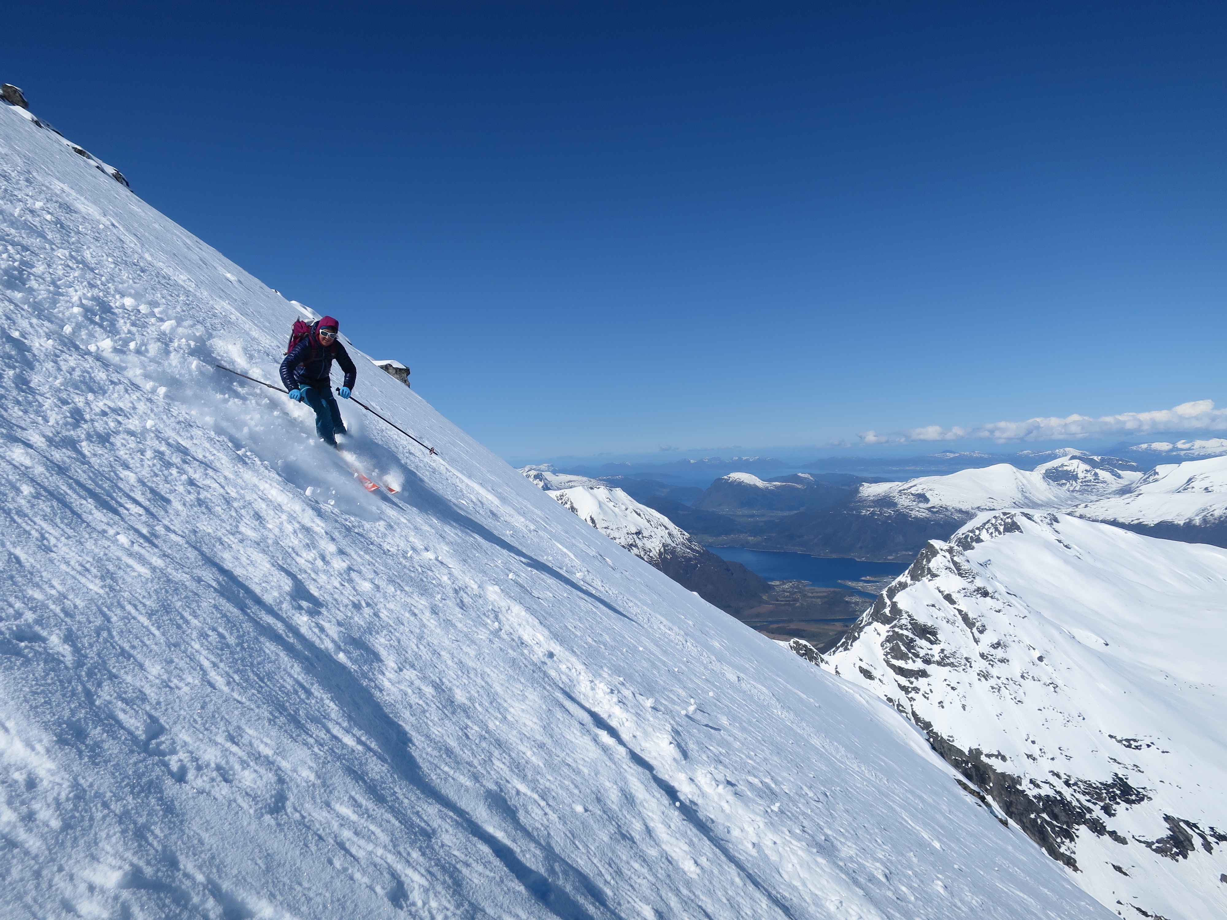
- Et déjà la redescente, avec toujours une vue juste magnifique
-

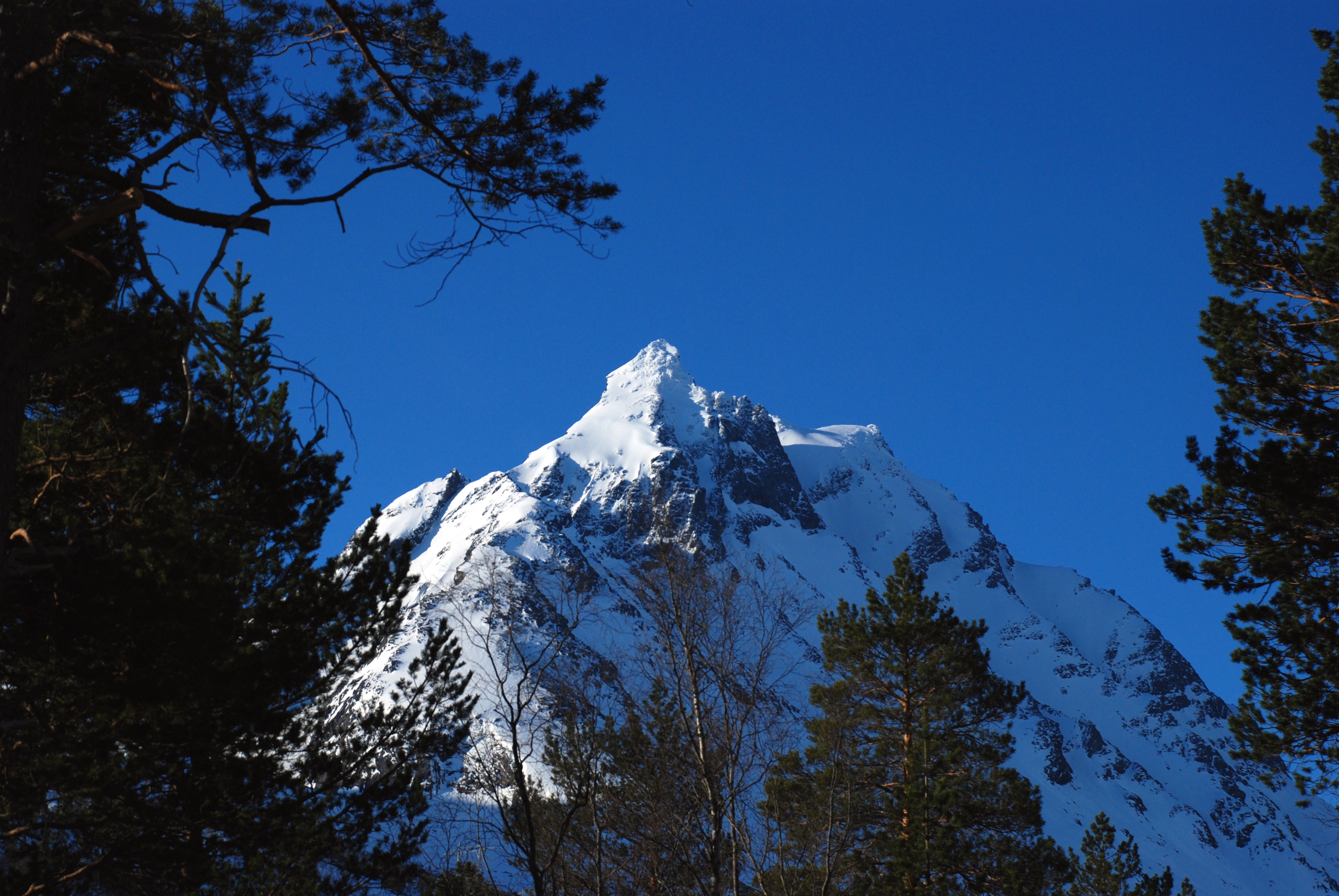
- Un dernier coup d’oeil sur la pyramide du Schrechorn
-

- Et un petit tracé… Toujours intéressant de voir sur une carte ce que ça donne ;)